
Himachal weather update: Caution advised as 3-day yellow alert issued for thunderstorms, lightning in isolated places


- Himachal High Court maintains stay on termination of 900 horticulture project employees - November 5, 2024
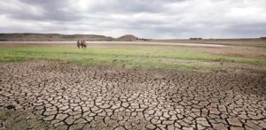
- Himachal weather: After month of drought-like conditions, rain likely on this day - November 5, 2024
- Himachal’s first online wedding leaves many perplexed, how ailing man’s wish forced it to happen - November 5, 2024
Keylong coldest in state at -4.6°C, Una warmest at 30.4°C
TNR Desk
The Meteorological Department has issued a yellow alert for Himachal Pradesh, signalling the possibility of thunderstorms accompanied by lightning and hail in isolated places on March 21, 22 and 24. The residents and tourists in the state have been advised to stay cautious during this period.
Keylong in Lagaul-Spiti reported the lowest minimum temperature at -4.6°C in the state while Una experienced the highest maximum temperature at 30.4°C.
Over the past 24 hours, thunderstorms have been reported in Shimla, Sundernagar, Bhunter and Kangra. Rainfall too was experienced at several places, including in Sundernagar (9.5 mm), Narkanda (5.5 mm), Bilaspur (5.4 mm), Ghaghas (5 mm), Shillaroo (4.7 mm), Slapper (3.8 mm), Pandoh (3 mm), Kufri (2.6 mm) and Bhunter (1.2 mm).
The temperature showed no significant change in both minimum and maximum temperatures over the last 24 hours. The average minimum temperatures remained normal, while the average maximum temperature was reported to be above normal in several parts.
The current weather patterns are influenced by a cyclonic circulation over northwest Uttar Pradesh and its surrounding areas, which is located between 1.5 and 3.1 km above mean sea level. Additionally, a western disturbance is present as a trough in the westerlies, stretching along longitude 80°E to the north of latitude 20°N, as per the Meteorological Department.
“Another disturbance is identified in the middle tropospheric westerlies, with its axis at 5.8 km above mean sea level, running along longitude 50°E to the north of latitude 30°N. A fresh western disturbance is expected to impact the western Himalayan region starting the night of March 23 (2024),” it said.